
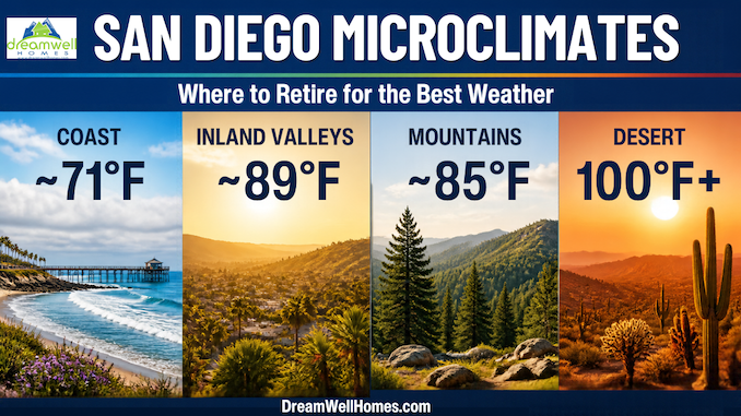
San Diego County does not have one climate. It has dozens. Within a 30-minute drive you can go from a 71°F August afternoon on the Oceanside harbor to an 89°F afternoon in Escondido. Keep driving east for about two hours and you reach the triple-digit desert heat of Borrego Springs. Choosing where to retire here is really choosing a microclimate, and it shapes your daily life far more than most buyers expect.
Most of the retirees we work with come here for two reasons. They want to be closer to children and grandchildren, and they want to leave extreme weather behind: Las Vegas and Phoenix summers, Texas heat and humidity, or East Coast winters and storms. This guide explains how San Diego’s microclimates work, what each season actually feels like, how to match a neighborhood to the way you want to live, and what the state’s newest climate science says about the decades ahead.
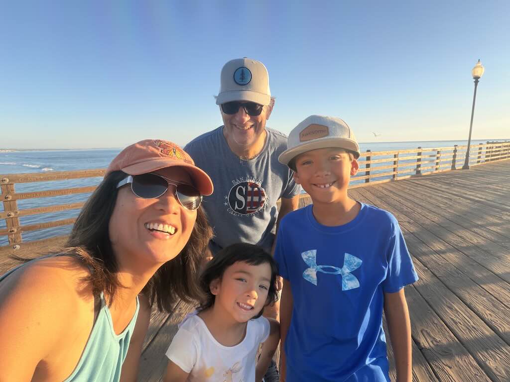
We are Jean Tritle, real estate broker (DRE# 01777754), and Ken Tritle, SRES® real estate agent (DRE# 01892793), of DreamWell Homes Realty, and we write this from experience, not just data. We also know firsthand what it means to leave extreme weather behind. Jean moved here from the Philippines, where tropical heat, humidity and typhoon season are part of life. Ken came from Pennsylvania, with its snowy winters and muggy summers. Jean has lived in North County San Diego since 1999 and Ken since 2000, about 9 miles from the beach, and neither of us has looked back. We work, play, garden, walk and entertain outdoors nearly year-round. We have also lived through May Gray, Santa Ana wind events, drought years and the newer reality of coastal heat waves. We want you to know all of it before you buy.
Why San Diego has so many microclimates
Three things set the weather at any San Diego address: distance from the ocean, elevation, and which way the wind is blowing. The National Weather Service’s San Diego office describes the county’s coastal, inland, mountain and desert zones as “highly distinct and very close together.” Its forecasters note that high temperatures at a foggy beach may be 15 degrees lower than under the sun only a mile inland.
The ocean is a giant thermostat. The California Current brings cold water down from the north, and upwelling pulls even colder water to the surface. A layer of cool, moist marine air sits over that water under a lid of warmer, drier air. Scientists call that lid a temperature inversion. When the marine layer pushes onshore, it brings low clouds and cool temperatures. The farther inland you go, the less often it reaches you.
Elevation adds rain and cold. Seasonal rainfall is about 10 inches in the city, rising to 20 to 40 inches in the mountains, depending on slope and elevation. The mountains also see frost and occasional snow.
The mountains block the desert. East of the Laguna and Cuyamaca mountains, the Anza-Borrego desert is a different world: very hot summers, mild winters and little rain.
| Zone | Example communities | Summer afternoons | Winter nights | Rain per year | Feel |
|---|---|---|---|---|---|
| Coastal (0–5 mi) | Oceanside, Carlsbad, Encinitas, Del Mar, La Jolla | Low to mid 70s °F | High 40s °F | ~10 in | Cool, often cloudy mornings, very steady |
| Inland valleys (5–25 mi) | San Marcos, Escondido, Rancho Bernardo, Rancho Peñasquitos, Rancho Santa Fe, Del Sur, Santaluz, Poway | Mid 80s to ~90 °F | Mid 40s °F, rare frost | ~12–15 in | Sunnier, warmer, bigger day-night swings |
| Mountains (3,000–6,000 ft) | Julian, Pine Valley, Mount Laguna | Warm days, cool nights | Below freezing at times | 20–40 in | Four seasons, occasional snow |
| Desert | Borrego Springs | 101–107 °F | Mid 40s °F | ~5 in | Dry, sunny, very hot summers |
Coast and valley figures are NOAA 1991–2020 U.S. Climate Normals for the Oceanside Marina and Escondido #2 stations, and desert figures are NOAA normals for Borrego Desert Park. Mountain rainfall comes from NOAA’s Climatography of San Diego.
Gardeners use an even finer map. The Sunset Western Garden Book climate zones split the coast into Zone 24 (marine-dominated, right along the beach) and Zone 23 (the thermal belts just inland, mild summers except during Santa Ana winds). If you love roses, citrus, avocados or tropical plants, your Sunset zone matters as much as your zip code.

The seasons as residents actually live them
San Diego’s seasons are subtle, but they are real. Here is what each part of the year feels like on the ground.
Spring and early summer: May Gray and June Gloom
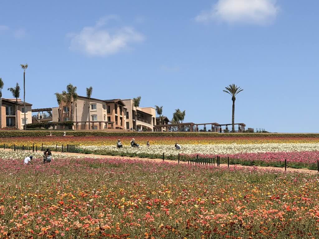
From roughly late April through June, coastal mornings often start under a low, flat gray cloud deck. Locals call it May Gray and June Gloom, and some stretch it to “No Sky July.” Scripps Institution of Oceanography project scientist Rachel Clemesha explains that the contrast between the cool ocean and warm air above it creates these clouds, and that the inversion tends to sit higher in May and June, letting clouds reach farther inland. On many days the sun burns through by late morning or early afternoon. Near the beach, some days it never does.
Your feelings about May Gray are one of the best predictors of where you will be happy. Some of our clients actively want it. It has been called a natural air conditioner that keeps spring and early summer comfortable, and it makes a morning walk or round of golf pleasant even in June. Others, especially sun-seekers from Arizona or Nevada, find weeks of gray mornings a letdown and prefer a few miles inland.
The cloud deck is also changing. Clemesha and her colleagues have linked a declining number of May and June fog days to urban land cover. A UC Santa Barbara study found a 25 to 50 percent drop in low summer clouds since the 1970s in the greater Los Angeles area, tied to urbanization and warming. Fewer clouds mean more sun, but also warmer coastal summers.
Late summer and early fall: the warmest stretch
At the coast, the warmest weather usually comes in August and September, and October is often as warm as July. Oceanside’s normal high is about 71°F from August through September. Inland valleys run much hotter. Escondido averages about 45 days a year at or above 90°F, concentrated from July to September.
A typical midsummer National Weather Service forecast shows the pattern clearly. For mid-July 2026, forecasters called for highs in the mid-70s along the coast, upper 80s to mid-90s in the valleys, around 91 in the mountains and up to 108 in the deserts. That staircase, a few degrees warmer every few miles inland, is the single most useful thing to understand about living here.
Fall into winter: Santa Ana winds
Santa Ana winds are hot, dry offshore winds that blow from the interior toward the coast. A study by Scripps researchers Janin Guzman-Morales, Alexander Gershunov and colleagues, published in Geophysical Research Letters, found the Santa Ana season runs from October to April, with events most frequent in December and strongest in January. The winds push the marine layer out to sea, and the same study found that early- and late-season Santa Anas drive coastal heat waves, one reason early fall is historically the hottest time of year at the coast.
They are also the main driver of wildfire risk. Research behind the U.S. Forest Service’s Santa Ana Wildfire Threat Index notes that vegetation is driest from late September through mid-November, so Santa Anas in that window carry the greatest fire potential. During strong events, SDG&E may shut off power to some North County neighborhoods to reduce fire risk. Most events pass within a few days, and many are mild. Some residents actually enjoy the crisp, clear, warm winter days they bring.
Winter: mild, green, and the rainy season
Winter is why many people move here. Coastal highs stay in the low 60s, nights rarely drop below the mid-40s, and you can golf, walk the beach or eat outdoors in January. About 80 percent of the year’s rain falls between November and March.
That rain is famously unreliable. Normal rainfall at San Diego’s airport is about 9.8 inches a year, but the San Diego County Water Authority’s records show it swinging from 3.30 inches in 2002 to 22.60 inches in 2005, and from 3.34 inches in 2018 to 15.77 inches in 2023. Multi-year droughts are part of life here. The practical effects for a homeowner are drought-tolerant landscaping, periodic watering restrictions and, in dry falls, higher fire danger. Regional water supply is more secure than many newcomers assume, which we cover in the practical questions below.
North County San Diego up close
North County packs the whole coast-to-valley staircase into a short drive. In winter, Oceanside and Escondido are only about 6°F apart. By August, the gap grows to about 18°F.
That difference is the heart of every decision we help North County buyers make. The coast gives you steady, mild days all year, with gray mornings in late spring. Each mile inland trades some of that steadiness for more sunshine and warmer afternoons.
Oceanside and Carlsbad by the beach
Within about a mile of the ocean, summer highs sit in the low 70s and winter highs in the low 60s. Oceanside averages fewer than one day a year at 90°F or above and almost never freezes. This is Sunset Zone 24, where the ocean dominates the weather. Oceanside is home to some of Southern California’s widest beaches and a nearly 2,000-foot pier, and Carlsbad offers seven miles of coastline and a lively village of shops and restaurants.
The tradeoff is May Gray and June Gloom, which can linger here into early afternoon, plus a damp, salty marine air that is gentle on people and harder on metal, paint and patio furniture. Mornings can be cool enough for a light jacket even in summer. For walkers, cyclists and anyone who dislikes heat, it is hard to beat.
The 3–9 mile sweet spot
Most of our clients land a few miles from the water. As Ken puts it, “Our clients would ideally want to be 3 to 5 miles from the beach.” In practice, the sweet spot stretches to about 9 miles. Here the marine layer still arrives most nights and mornings, but it tends to burn off sooner, so you get more afternoon sun. Summer afternoons run several degrees warmer than at the beach, and winter nights are a little cooler.
This is also where you find more single-level homes, newer construction and lifestyle communities, often at a better price per square foot than beach-walkable homes. It is the compromise that works for most people who want coastal climate without coastal crowding or coastal prices. These distances overlap with the zones in the table above, because microclimates blend gradually rather than changing at a line on a map.
Ocean Hills Country Club
Ocean Hills Country Club, the 55+ community in Oceanside where we focus much of our work, sits inland of the beach towns along the Oceanside–Carlsbad border, about 3.5 miles from the beach as the crow flies. Residents typically enjoy marine-cooled summers, more sun than the beach on May and June afternoons, and mild winters that keep the golf course, pools, tennis and pickleball courts busy all year. On the hottest late-summer days it feels warmer than the coast, so AC is a smart feature in any Ocean Hills home.
San Marcos and the inland valleys
San Marcos sits between Oceanside and Escondido, both in distance from the ocean and in temperature, and it still retains plenty of its country character. Expect sunnier mornings, warmer summers with afternoons in the mid to upper 80s, and cooler winter nights. If you are used to Arizona or Texas summers, these will feel far gentler.
Our own experience, 9 miles inland
We live about 9 miles from the beach, and our winters are mild enough that we keep up most of our activities all year. For most of our time here, air conditioning felt optional near the coast. That has changed. Occasional heat waves now push temperatures up even in coastal Carlsbad and Oceanside, and we now tell every buyer to treat AC as a must-have rather than a nice-to-have.
One of the best parts of living here is how easy it is to escape the heat. From our experience, on heat-wave days when temperatures at our home can reach 100 degrees, a 10 to 12 minute drive toward the ocean can drop the temperature several degrees. In the summer of 2026, on one of those hot afternoons, we drove from home to the Oceanside Pier for a walk. The ocean breeze made it far more comfortable, and we were glad we didn’t have to go far. Carlsbad is really our main sanctuary when it gets hot, along with Oceanside. We walk the beach, eat out and stroll Carlsbad’s quaint downtown village, and by the time we head home the heat has usually eased. When we want a real change of air for a local getaway, Big Bear’s cool mountain weather is only a couple of hours’ drive away.
If North County isn’t your climate: other choices in the county
If the coast feels too gray or the valleys too hot, San Diego County offers other profiles within the same metro area, the same airport and often the same drive to family.
Rancho Bernardo (inland, balmy). Rancho Bernardo is a quiet suburban neighborhood tucked away in San Diego’s inland foothills along I-15, roughly 12 to 15 miles from the ocean. Expect more sunshine, warmer mornings and summer afternoons that commonly reach the mid-80s to 90°F, with cooler, clearer winter nights. It offers golf courses, nearby wineries, quick freeway access and several 55+ communities, including Oaks North and Seven Oaks. It is also wildland-adjacent: the 2007 Witch Creek Fire destroyed 365 homes in Rancho Bernardo alone. Today’s construction codes and defensible-space rules are much stricter, but fire-hazard zoning and insurance belong on your checklist here.
Rancho Peñasquitos (inland, in between). Closer to the coast than Rancho Bernardo, Rancho Peñasquitos is a community of canyons, hillsides and ridges around Black Mountain Regional Park. It often gets morning marine-layer clouds that burn off earlier than at the beach. Afternoons are warmer than the coast but usually a few degrees milder than farther inland. It suits buyers who want warmth and sun without full valley heat.
Rancho Santa Fe (inland, estate living). Set a few miles east of the Pacific, Rancho Santa Fe trades some coastal cool for more sunshine and warmer summer afternoons than Del Mar or Solana Beach. It is known for horse ranches, estate homes on rolling hills, golf and a quaint central village, and it is minutes from the coast on hot days. Its wooded, hilly setting also means wildfire planning matters: the 2007 Witch Creek Fire reached parts of Rancho Santa Fe, so check fire-hazard zoning and insurability early.
Carmel Valley (coastal-influenced, newer neighborhoods). Carmel Valley is a master-planned community along the Interstate 5 corridor, a few miles inland from Del Mar. Mornings often start with marine-layer clouds that clear earlier than at the beach, and afternoons stay warm but rarely hot. Buyers like its newer neighborhoods, parks and trails, shopping and dining, and easy access to the medical and research hubs of La Jolla and Sorrento Valley.
Del Sur (inland, newer 55+ options). Del Sur is a master-planned community in northern San Diego, roughly 10 miles inland. It is close to Black Mountain Ranch, a relatively new City of San Diego community that lies west of 4S Ranch and Rancho Peñasquitos and east of Fairbanks Ranch and Rancho Santa Fe Farms. Its climate is classic inland valley: sunnier mornings, warm to hot summer afternoons and mild winters, so AC is a must. For buyers who want newer construction and an active 55+ lifestyle without coastal prices, it is a strong alternative to the beach towns. Two communities we know well are Auberge at Del Sur and Avante at Del Sur. Auberge offers single-level homes, both attached and detached, while Avante offers two-story condos with in-home elevators, so stairs are never a concern.
Santaluz (inland, gated estate living). Next door to Del Sur, Santaluz was the first stage of the City’s Black Mountain Ranch community, a 3,690-acre development. It is a gated community known for estate homes, open space and trails, and a private golf club. The climate matches Del Sur’s: sunny, warm to hot summer afternoons and mild winters, so plan on AC. Because many homes border canyons and open space, check fire-hazard zoning and insurability early.
The mountains (four seasons). Julian, high in the Cuyamaca Mountains and famous for its apple orchards and Old West downtown, offers a real winter, with frosty nights and occasional snow, and warm summer days. Rainfall is far higher than at the coast. These towns are lovely for a cabin or second home. For a primary home, weigh winter driving, distance to hospitals and higher wildfire exposure.
The desert (dry heat). Borrego Springs, a desert resort community and gateway to Anza-Borrego Desert State Park, has glorious winters and brutal summers. NOAA normals put average July and August highs near 107°F. It hit a record 120°F on July 8, 2024. Many people enjoy it as a winter retreat rather than a year-round home.
Other areas also have their own profiles. Along the coast, Solana Beach offers a mellow, small-town feel and the Cedros Design District, La Jolla pairs a dramatic coastline with an upscale village, Del Mar has its own village and beaches, and Coronado, a seaside community with a small-town feel just across the bay from downtown, enjoys a classic coastal climate. Around Rancho Santa Fe, communities such as Fairbanks Ranch and Del Mar Mesa offer gated and estate-style living with a similar sunny, slightly warmer climate. Farther inland, Lake San Marcos offers paddleboarding, fishing and waterfront dining at a relaxed pace. Vista and Fallbrook sit to the north, and Ramona, Poway, El Cajon and Santee lie to the east. The pattern holds everywhere: the closer to the ocean and the lower the elevation, the milder and steadier the weather.
Looking ahead: what California’s newest climate science says about San Diego
San Diego will stay one of the mildest places in the country, but it is getting warmer, and the coast will keep its advantage. That is the bottom line of the San Diego Regional Report, part of California’s Fifth Climate Change Assessment released in October 2026. Scripps Institution of Oceanography climate scientists Julie Kalansky and Tom Corringham led the report, with roughly 80 authors. For anyone buying a home to keep for 15 or 20 years, it is one of the most authoritative looks at where local weather is heading.
Kalansky summed up the region’s challenge in words every buyer here should hear: “San Diego has a complex topography and microclimates which makes adaptations across the region varied and challenging, but we are fortunate to work in a region with many dedicated to advancing climate research and using the information to build resilience,” she said in Scripps’ announcement of the report.
For buyers, the takeaway is practical. Because climate risk plays out differently from one canyon, mesa, valley floor or bluff to the next, there is no single answer for “San Diego.” How a home will fare depends on its exact location. The good news is the other half of her point: the research coming out of Scripps, SDSU and the region’s other institutions gives buyers here unusually good tools for making that choice, like the Heat Risk Explorer covered below.
| What the report projects | What it means when you choose a home |
|---|---|
| Temperatures up about 4°F by mid-century (2041–2070), compared with the 30 years ending in 2010 | Treat AC as standard everywhere, and favor energy-efficient homes with good insulation, dual-pane windows and solar |
| Inland areas warming at least 1°F more than the coast | The coastal advantage grows over time. Homes near the ocean keep the mildest climate in the county |
| Warming strongest in spring and fall, effectively extending summer | Expect warmer Septembers and Octobers and fewer cool late-spring days, as the October 2026 heat wave showed |
| Rain falling more often in short, intense storms, even though total rainfall is uncertain | Check roof condition, drainage, slope stability and flood-zone status during inspections |
| Sea level up 1.0 to 1.6 feet by 2075 | Bluff-top and beachfront homes need extra due diligence. Homes a few blocks back or a few miles inland are far less exposed, though low-lying areas near bays and lagoons can still flood at high tide |
| Major wildfire risk still tied to fall and early-winter Santa Ana winds | Fire-hazard zone and insurability matter most in canyon- and brush-adjacent neighborhoods |
| Heat-related illness and respiratory conditions rising, with older adults among the most vulnerable groups | Health-supportive features matter: AC, good air filtration, single-level living and proximity to medical care |
The state’s Climate Resilience portal looks further out. It projects average temperatures 4 to 9°F higher by 2100 under intermediate to high emissions, 20 to 50 percent more heat-wave days with a 6°F rise, and sea level 1.6 to 3.2 feet higher along the county coast by 2100.
Our take after more than 25 years here: none of this changes why people move to San Diego. It does make where you buy within the county matter more than it used to. A home a few miles from the ocean, outside high fire-hazard zones, with AC and efficient systems, is positioned well for the decades ahead.
Planning a move to San Diego? Sign up for our 55+ Email Newsletter and Guide to Relocating and Retiring to San Diego for local insights like these, delivered to your inbox.
Practical questions buyers ask us
Do I need air conditioning?
Inland, yes. Near the coast, it used to be optional, and today we recommend it.
For decades, many coastal homes in Oceanside and Carlsbad were built without AC because the marine layer kept summers mild. Oceanside’s NOAA normals still show fewer than one day a year at or above 90°F. But the exceptions now matter more. A 2018 study in the journal GeoHealth, by a team that included Scripps researchers Alexander Gershunov and Rachel Clemesha, found that coastal residents were more sensitive to heat than inland residents, and that heat-related illness was higher in coastal zip codes where AC is least common.
What we have seen ourselves: a handful of hot, sticky days each late summer and fall, usually when Santa Ana winds or a strong high-pressure ridge push the marine layer offshore. For most buyers, central air or an efficient heat pump is now a comfort and health feature, not a luxury. When we tour coastal homes, we always check whether the home has AC, whether it can be added and what the electrical panel supports.
The October 2026 heat wave showed why. Forecasters expected coastal highs in the mid-80s to mid-90s, inland valleys at 98 to 104°F and overnight lows in the 70s, 15 to 25 degrees above normal west of the mountains. Warm nights are the hardest part for a home without AC, because the house never gets a chance to cool down.
How can I check heat risk for a specific address?
Use the free San Diego Heat Risk Explorer. It was built by the Southern California Extreme Heat Research Hub at Scripps Institution of Oceanography and the San Diego Regional Climate Collaborative at the University of San Diego, as part of the state-funded Shade SD initiative. The map combines more than 75 public datasets to score heat risk across the county, neighborhood by neighborhood.
Its most useful insight for coastal buyers: the coast is cooler by day, but project data scientist Connor Mack, a Scripps PhD student, has found that coastal neighborhoods can carry high nighttime heat risk because of the marine layer, limited overnight cooling and humidity. That matches what we saw in the October 2026 heat wave, and it is another reason we recommend AC even near the beach.
To check a home you are considering:
- Open the map and type the address into Find address.
- Under heat exposure, switch between daytime, nighttime and humid heat to see how the location compares at different times of day.
- Change the climate scenario to mid-century (2050) to see how exposure is projected to change over the years you will own the home.
- Turn on Cool Zones to see the nearest free, air-conditioned public refuges, such as libraries and senior centers.
We are happy to walk through the map with you for any home on your list.
What about wildfire and insurance?
Wildfire risk in San Diego County is real but very local. It depends mostly on how close a home sits to undeveloped brush, canyons and hillsides, and on its construction. Two local examples show why location matters:
- The 2007 Witch Creek Fire destroyed 1,141 homes countywide, including 365 in Rancho Bernardo.
- The 2017 Lilac Fire destroyed 157 structures, many of them in the Rancho Monserate Country Club, a manufactured-home community near Fallbrook and Bonsall.
Before you write an offer, look up the address on CAL FIRE’s Fire Hazard Severity Zone maps. The state released updated local-area maps on March 24, 2025, and many cities adopted them that summer. Then get an insurance quote during your inspection period, not after closing. Insurance has become harder to find statewide: property insured through the California FAIR Plan, the insurer of last resort, grew from about $50 billion in 2018 to roughly $750 billion as of March 2026. Homes in town, away from open brush and closer to the coast, generally carry lower fire risk and are easier to insure.
What about flooding?
Most of San Diego County rarely floods, but it does happen, in two different ways.
Storm flooding. Intense rain can overwhelm creeks and storm drains in low-lying neighborhoods. On January 22, 2024, San Diego recorded 2.73 inches of rain, its fourth-wettest day since 1850, and more than 100 homes in Southcrest and Mountain View were left uninhabitable. The state’s climate assessment expects rain to arrive more often in short, intense storms, so drainage matters more than it used to.
Tidal flooding. Very high tides can flood low streets near the bay and beaches even on dry days. In late October 2026, the National Weather Service issued a coastal flood warning for the county coast, with morning high tides running 1 to 1.7 feet above predictions. The Port of San Diego warned of street flooding along the Embarcadero and in Point Loma, and water reached side streets in Mission Bay.
For any home you are considering, check its flood zone on FEMA’s Flood Map Service Center, look at the lot’s grading and drainage, and ask the sellers about past water intrusion. Standard homeowners policies do not cover flood, so price a separate flood policy for any home near a creek, a low-lying street or the shoreline.
El Niño, wildfire and the coast: why your exact location matters
A mild climate does not mean calm weather every winter. As San Diego Unified prepared its schools for the coming season, Julie Garcia, the district’s senior director of future-ready learning, curriculum and instruction, described El Niño to KPBS this way: “It is a recurring Pacific Ocean atmosphere pattern that can influence fall and winter weather across San Diego.”
The 2026–27 winter is shaping up to be a real test. On October 8, 2026, NOAA’s Climate Prediction Center had an El Niño Advisory in effect, with a strong to very strong El Niño likely through January–March 2027. Scripps Institution of Oceanography notes NOAA’s forecast that this event could be among the strongest on record. Outcomes still vary: as San Diego State University climate researcher Samuel Shen points out in What is El Niño?, the 2015–16 El Niño did not produce extreme rain here, so the goal is preparation, not alarm. El Niño is a natural, recurring cycle, but California’s climate assessment expects a warming climate to bring rain in shorter, more intense storms. Heavy downpours, localized flooding and sudden storms are part of planning for any home here, as they increasingly are around the world.
That is why choosing a home here takes more than choosing a microclimate. The microclimate tells you how a neighborhood feels day to day. The exact location tells you how a specific property holds up against storms, wildfire and the sea, and two homes on the same street can face very different risks. Here is what we look at:
- Wildland edges: Does the home back onto open brush, canyons or hillsides? Homes near wildlands carry higher wildfire risk, so check the CAL FIRE Fire Hazard Severity Zone, defensible space and how many evacuation routes the neighborhood has.
- Bluffs and shoreline: Is the home on or near a coastal bluff? Big surf, high tides and El Niño’s higher sea levels add erosion risk, covered in the next question.
- Low-lying land and creeks: Is the home in a low spot, near a creek, river channel or canyon bottom, or on a street where water collects after heavy rain? Check the FEMA flood zone and ask about past water intrusion.
- Slopes and hillsides: Homes on or below steep slopes need a close look at drainage and slope stability, because saturated soil can move.
- Burn scars: Hillsides burned by recent wildfires shed water and debris much faster. After the 2007 fires, the U.S. Geological Survey mapped debris-flow hazards from burned basins in San Diego County.
- Nearby roads and amenities: Even when a home comes through a storm or fire untouched, daily life can be disrupted if what it depends on is vulnerable. Look at whether the main road or only route out crosses a low spot or runs along a bluff, and how close the nearest hospital, pharmacy and grocery store are, and whether reaching them depends on those routes. Ask how the area fared in past events, including road closures, evacuations and power shutoffs during Santa Ana winds.
- Roofs, gutters and drains: The same work the school district is doing, clearing roof drains and storm drain inlets, is smart for every homeowner before winter.
This is where working with local real estate professionals makes a real difference. Regional climate data cannot tell you which streets tend to pond after a storm, which neighborhoods sit right against the wildland edge, which roads close first or which slopes deserve a closer look. Agents who live and work here can. Pair that local knowledge with a thorough home inspection, a FEMA flood-zone check and, where needed, a geotechnical report, and you can choose a home that fits both your lifestyle and the weather it will face.
Should I buy right on the beach or a bluff?
Living right on the sand or the bluff is a dream for many buyers, and the rewards are real. So are the risks, and we want you to weigh both.
| Pros | Cons |
|---|---|
| Unobstructed ocean views and the sound of the surf | Erosion, bluff collapse and storm-surf damage |
| Walk straight onto the sand | Higher exposure to tidal flooding and sea level rise |
| The coolest, steadiest temperatures in the county | Salt air means more maintenance for metal, paint, windows and HVAC |
| Scarce supply supports strong long-term demand | Insurance can be harder to find and more expensive |
| A front-row lifestyle that is hard to replicate | California Coastal Commission rules can limit seawalls and major remodels near the bluff edge |
Headlines from fall 2026 show what is at stake. In early October 2026, waves from the remnants of Tropical Storm Rachel washed sand from beneath foundations on the Long Beach Peninsula, and 13 structures were red-tagged as unsafe. Closer to home, Scripps Institution of Oceanography notes that El Niño events bring higher sea levels, bigger waves, and increased coastal erosion, which puts beachfront and bluff-top homes at greater risk during a strong El Niño winter like 2026–27.
None of this means you should rule out the beach. It means doing extra homework:
- Order a geotechnical or bluff-stability report for any bluff-top property.
- Ask about the home’s seawall or shoreline protection, its permits and its maintenance history.
- Check the flood zone and get insurance quotes, including flood, during your inspection period.
- Ask the city about bluff setback rules before planning any remodel.
For many buyers, the sweet spot is a home a few blocks back from the sand. You keep the ocean breeze and the walk to the beach, with far less exposure. That is exactly what our client from Austin chose.
Will there be enough water?
Droughts happen here, but the region has invested heavily in its supply. After a severe drought in 1991 cut San Diego’s imported water by 31 percent, the County Water Authority began diversifying its supply. The Claude “Bud” Lewis Carlsbad Desalination Plant, the largest in the nation, has met about 10 percent of the region’s water demand since 2015, regardless of rainfall. In practice, drought for a homeowner here means water-wise landscaping and occasional watering limits, not dry taps.
How does it compare with where I live now?
Compared with most of the United States, San Diego’s mild zones are genuinely enviable. No snow to shovel, hurricanes are extremely rare, and there are no months of triple-digit heat. Many locals, us included, will admit the weather has spoiled us. Here is how it stacks up against the places our clients most often come from.
| If you’re coming from | What you leave behind | What you’ll notice here |
|---|---|---|
| Phoenix / Scottsdale | A record streak of more than 100 straight days at or above 100°F in 2024 | Coastal summers in the 70s; inland summers similar to a Phoenix spring |
| Las Vegas | A record 101+ days at 100°F or more in 2024 | Ocean humidity instead of desert dryness; cooler nights everywhere |
| Austin and Texas | Long, humid summers and severe storms | Low summer humidity inland, sea breezes on the coast, almost no summer rain |
| East Coast | Snow, ice, hurricanes, muggy summers | No snow below the mountains, hurricanes extremely rare, mild 60s °F winters |
| Pacific Northwest | Long gray, wet winters | Far more sun; May Gray is the closest thing to a Seattle sky |
The tradeoffs are different, not absent: higher home prices, wildfire seasons, occasional drought, and coastal clouds in late spring.
Which microclimate fits the way you want to retire?
The right microclimate is the one that matches what you want to do every day. Start with the activities that will get you out of bed excited, then match them to a zone.
| If your ideal day looks like… | Look at | Why |
|---|---|---|
| A beach walk, coffee by the water, fresh ocean air | Coastal Oceanside or Carlsbad, walkable to the beach | Coolest, steadiest temperatures; May Gray mornings are part of the deal |
| Golf, pickleball and pool most days, with the beach a short drive away | 3–9 miles inland, including communities like Ocean Hills Country Club | Marine breezes with more afternoon sun and more home for the money |
| Warm, sunny mornings and swimming-pool summers | Rancho Bernardo, San Marcos, Escondido | Sunniest and warmest, but plan on AC and summer heat |
| A garden full of citrus, avocados and roses | Coastal thermal belts (Sunset Zone 23) | Nearly frost-free with enough warmth to ripen fruit |
| Four seasons, fall color and an occasional snowfall | Julian or the eastern foothills | Real winter, at the cost of distance and fire exposure |
| Escaping cold winters for a few months a year | Coastal second home, or Borrego Springs in winter | Mild 60s °F winters on the coast; desert sun in season |
Questions to ask yourself before you choose
- Do cool, cloudy mornings feel cozy to you, or do they dampen your mood?
- How do you feel about 90°F afternoons? Is a pool day a joy or something to wait out indoors?
- Do you want to walk to the beach, or is a 10-minute drive fine?
- Is the home’s view, size and single-level layout more important than being on the sand?
- How close do you want to be to family, hospitals, the airport and specialists?
- Will this be a primary home, or a second home first?
Walkable to the beach vs. 3–9 miles inland
Most of our clients say they want a coastal climate and many want to walk to the beach. Fewer realize how much that narrows the choices. Beach-walkable homes are scarcer and more expensive, and many are townhomes, condos or older multilevel homes on small lots. A short drive inland usually buys a newer, single-level home with a yard, often in a gated or amenity-rich community, while keeping most of the coastal breeze.
There is no wrong answer, only a tradeoff. One of our clients, a buyer relocating from Austin, Texas, started out seriously considering Ocean Hills Country Club. As we toured and talked through daily routines, it became clear that being near the water mattered most. In the end, the client chose an ocean-view townhome just blocks from the beach in Oceanside. Another client might make the opposite choice for the same reasons. Our job is to help you see the tradeoff clearly before you decide.
Experience the microclimates before you buy
The best way to choose is to feel the difference yourself. We suggest visiting twice if you can, once in May or June and once in late August or September, and spending a morning at the coast and an afternoon inland on the same day. You will know quickly which one feels like home. Any day of the year, you can see the microclimates at work by comparing the coast, valley, mountain and desert forecasts from the National Weather Service in San Diego.
We would be glad to plan that day with you. Since 2010, DreamWell Homes Realty has helped buyers, including many retirees and second-home buyers, find the right fit across North County, from beach-walkable townhomes in Oceanside to single-level homes in Ocean Hills Country Club. Whether or not a 55+ community is right for you, we can help. Call or text Jean and Ken of DreamWell Homes Realty at 760-798-9024 to start a conversation, and sign up for our 55+ Email Newsletter and Guide to Relocating and Retiring to San Diego so you have the information you need when you are ready.
Climate figures are long-term averages and individual years vary. For wildfire and insurance questions on a specific property, consult CAL FIRE’s hazard maps and a licensed insurance agent. DreamWell Homes Realty supports equal housing opportunity and follows all federal and state fair housing laws. Area descriptions in this article refer to climate, homes and amenities, not to the people who live there.
Sources
- Climate data (NOAA and National Weather Service): NOAA 1991–2020 U.S. Climate Normals for Oceanside Marina, Escondido #2, Borrego Desert Park and San Diego Lindbergh Field; NWS San Diego, current forecasts and conditions and The Weather Guide; NWS San Diego, Station climatic narrative for San Diego; NOAA, Climatography of San Diego
- Climate research: California’s Fifth Climate Change Assessment, San Diego Regional Report (2026); Scripps Institution of Oceanography, What Climate Change Is Costing California (October 2026); UC San Diego Today, What Climate Change Is Costing California (October 20, 2026); State of California, Climate Resilience: San Diego region; Guzman-Morales et al., Santa Ana Winds of Southern California (Geophysical Research Letters, 2016); Rolinski et al., The Santa Ana Wildfire Threat Index; NOAA, Heat, Disparities, and Health Outcomes in San Diego County’s Diverse Climate Zones; UC Santa Barbara, Too Much Sun? (2018)
- Heat tools: Southern California Extreme Heat Research Hub (Scripps) and San Diego Regional Climate Collaborative, San Diego Heat Risk Explorer; Times of San Diego, New heat-mapping tool tracks risk across San Diego (June 26, 2026)
- Water: San Diego County Water Authority, Annual rainfall at Lindbergh Field, History and Seawater desalination
- Wildfire and flooding: City of San Diego Fire-Rescue, 2007 Witch Creek and Guejito Fires and Fire Hazard Severity Zone map; FEMA, Flood Map Service Center
- Community descriptions: San Diego Tourism Authority guides to Oceanside, Carlsbad, Solana Beach, Rancho Santa Fe, La Jolla, Coronado, San Marcos, Rancho Bernardo and Borrego Springs; City of San Diego community profiles for Carmel Valley and Rancho Peñasquitos, City Council District 5, Black Mountain Ranch, and City of San Diego Planning, Black Mountain Ranch community profile; Julian Chamber of Commerce, Visit Julian; UC ANR, Sunset Western Garden Book zone map
- News coverage: NBC 7 San Diego, Why May Gray happens; KPBS, What happens if there are fewer May Gray days? (2022), Extreme heat to remain in San Diego County (October 5, 2026), Port issues warning of street flooding as high tides hit San Diego (October 27, 2026) and Huge wildfires merge, continue pushing west (2007); KPBS, Chance for thunderstorms this week in San Diego mountains as temps increase (July 13, 2026); Times of San Diego, 4th wettest day since 1850 (January 2024); ABC 10News, Santa Ana winds and power shutoffs; CBS 8, Lilac Fire reaches full containment (2017); ABC7 Los Angeles, Tropical Storm Rachel leaves 13 structures red-tagged in Long Beach (October 2026); Borrego Sun, Record high temperatures (July 2024); Associated Press via ABC News, Phoenix reaches 100 degrees for a record 100th straight day (September 2024); KTNV, Las Vegas breaks its record for most 100-degree days (September 2024)
- El Niño and storms: NOAA Climate Prediction Center, ENSO Diagnostic Discussion (October 8, 2026); KPBS, San Diego Unified prepares for El Niño with safety work, curriculum addition (October 20, 2026); U.S. Geological Survey, Debris-flow hazards from basins burned in 2007, San Diego County; Scripps Institution of Oceanography, El Niño Resources; San Diego State University, What is El Niño? (October 21, 2026)

